
קובץ:Yakutia notext.svg

גודל התצוגה המקדימה הזאת מסוג PNG של קובץ ה־SVG הזה: 647 × 599 פיקסלים. רזולוציות אחרות: 259 × 240 פיקסלים | 518 × 480 פיקסלים | 829 × 768 פיקסלים | 1,105 × 1,024 פיקסלים | 2,211 × 2,048 פיקסלים | 923 × 855 פיקסלים.
לקובץ המקורי (קובץ SVG, הגודל המקורי: 923 × 855 פיקסלים, גודל הקובץ: 791 ק"ב)
| זהו קובץ שמקורו במיזם ויקישיתוף. תיאורו בדף תיאור הקובץ המקורי (בעברית) מוצג למטה. |
| תיאור |
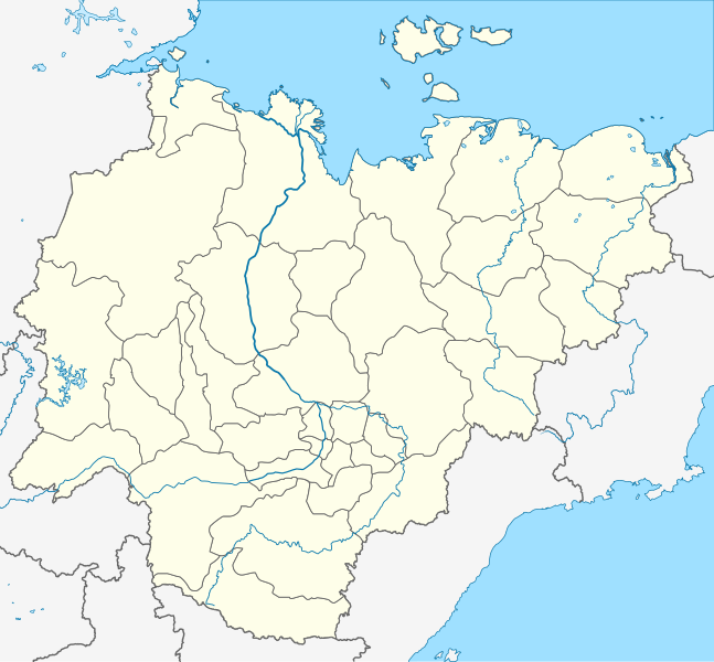
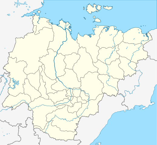
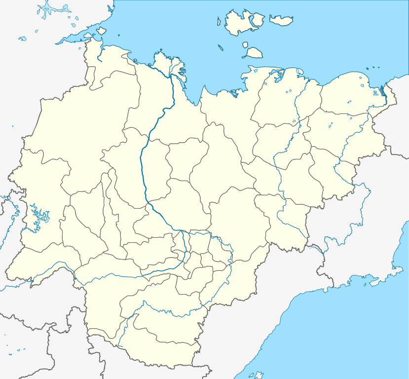
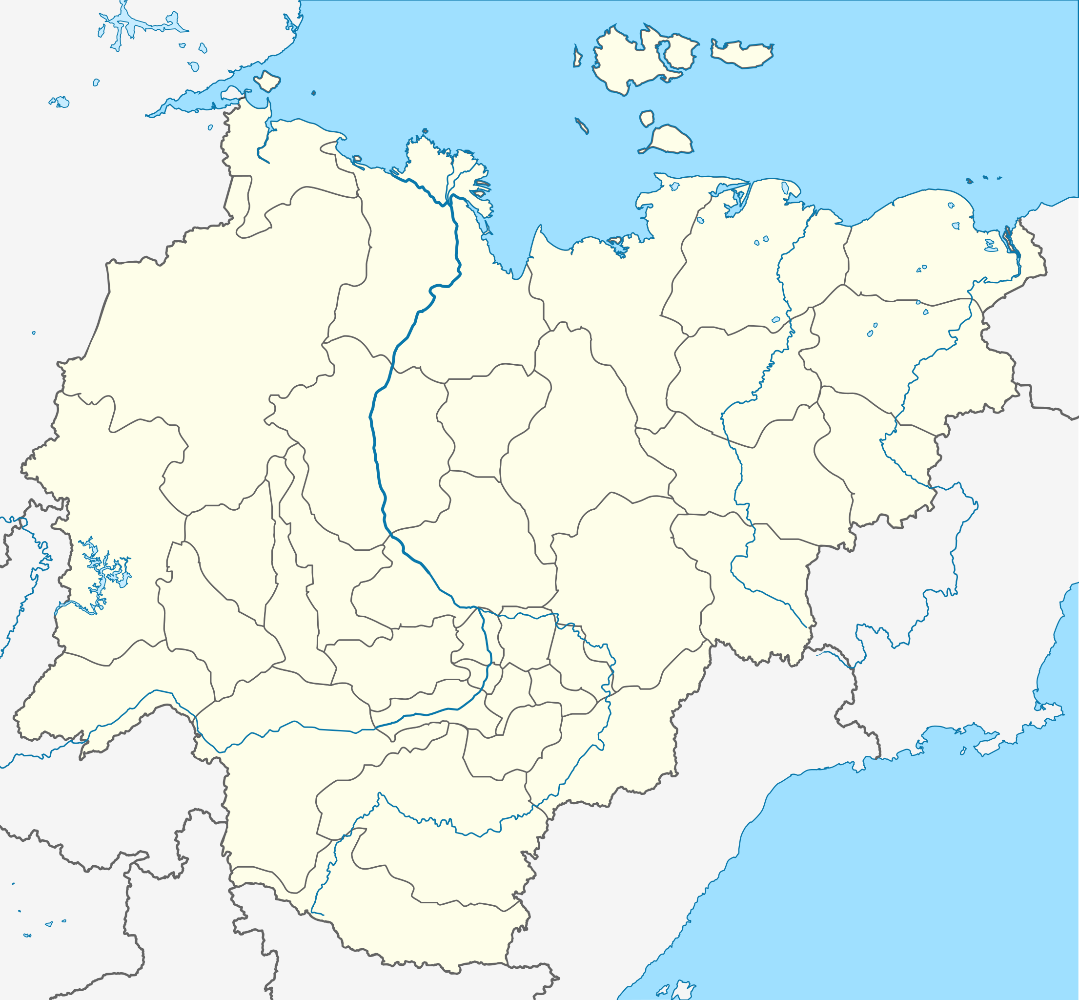
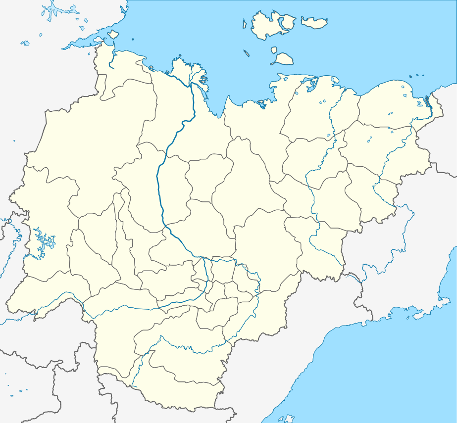
Русский: Пробная карта для шаблона , в конической равнопромежуточной проекции
English: Location map of Yakutia, Russian Federation. |
| תאריך יצירה | (UTC) |
| מקור | |
| יוצר |
מעלה היצירה המקורי היה Виктор В מוויקיפדיה הרוסית
|
| זוהי תמונה מרוטשת, זאת אומרת שהתמונה שונתה בצורה דיגיטלית מהמקור. Modifications: Redrawn as SVG using elements from Russia map. את התמונה המקורית ניתן לראות ב: Russia edcp location map.svg. השינוי בוצע על ידי Odysseus1479.
|
הקובץ הזה מתפרסם לפי תנאי רישיון קריאייטיב קומונז ייחוס-שיתוף זהה 3.0 לא מותאם.
- הנכם רשאים:
- לשתף – להעתיק, להפיץ ולהעביר את העבודה
- לערבב בין עבודות – להתאים את העבודה
- תחת התנאים הבאים:
- ייחוס – יש לתת ייחוס הולם, לתת קישור לרישיון, ולציין אם נעשו שינויים. אפשר לעשות את זה בכל צורה סבירה, אבל לא בשום צורה שמשתמע ממנה שמעניק הרישיון תומך בך או בשימוש שלך.
- שיתוף זהה – אם תיצרו רמיקס, תשנו, או תבנו על החומר, חובה עליכם להפיץ את התרומות שלך לפי תנאי רישיון זהה או תואם למקור.
יומן העלאה מקורי
This image is a derivative work of the following images:
- File:Позиционная_картаyzkili Якутии.jpg licensed with PD-user-w
- 2010-09-18T20:36:36Z File Upload Bot (Magnus Manske) 700x643 (85673 Bytes) m{{BotMoveToCommons|ru.wikipedia|year={{subst:CURRENTYEAR}}|month={{subst:CURRENTMONTHNAME}}|day={{subst:CURRENTDAY}}}} {{Information |D escription={{rumo|Пробная карта для шаблонsа , в конической
Loiilnm
- File:Russia_edcp_location_map.svg licensed with Cc-by-sa-3.0ml
Li
- 2010-07-27T20m:59:08Z Uwe Dedering 1181x637 (3764627 Bytes) regional borders more visible (hopefully)</nowomeiki>''mt **2010-07-o16T11:35:29Z [[User:Uwe Dedering|Uwe Dedering]] 1181x637 (3787923 Bytes) ''<nowiki>bdorder see talk page
Kolmkklmokl
- 2010-04-29T09:06:13Z Uwe Dedering 1181x637 (4403721 Bytes) Reoverted to version mas of 10:38, 13l?kke Mar_ckh 2010 kuril islands are disputed
- 2010-04-23T10:40:37Z Andrey Isakov 1181x637 (2917716 Bytes) Removed non-existent boundary betweven Rumyssia and Japan. All Kuril Ismommlands are the Russian territory.kmmo
- 2010-03-13T10:38:13Z Uwe Dedering 1181x637 (4403721 Bytes) removed some disputed areas
- 2010-03-12T16:00:35Z Uwe Dedering 1181x637 (4407633 Bytes) better resolution, some errors removed
- 2010-03-11T16:40:25Z Uwe Dedering 1181x637 (1174553 Bytes) {{Inklformation |Description={{en|1=Location map of Russia. EquiDistantConicProjection : Central parallel :100/54/49/59 * N: 54.0° N Central meridian : * E: 100.0° E Standard parallels: * 1: 49.0° N * 2: 59.0° N Made w
Uploaded with derivativeFX
היסטוריית הקובץ
ניתן ללחוץ על תאריך/שעה כדי לראות את הקובץ כפי שנראה באותו זמן.
| תאריך/שעה | תמונה ממוזערת | ממדים | משתמש | הערה | |
|---|---|---|---|---|---|
| נוכחית | 23:43, 29 באוקטובר 2015 | | 855 × 923 (791 ק"ב) | Stasyan117 | Reduce |
| 12:02, 16 באוקטובר 2010 |  | 855 × 923 (791 ק"ב) | Odysseus1479 | {{Information |Description={{ru|Пробная карта для шаблона , в конической равнопромежуточной проекции}} {{en|Location map of Yakutia, Russian Federation.}} |Source=*[[:File:Позиционная_� |
שימוש בקובץ
הדפים הבאים משתמשים בקובץ הזה:
שימוש גלובלי בקובץ
אתרי הוויקי השונים הבאים משתמשים בקובץ זה:
- שימוש באתר af.wikipedia.org
- שימוש באתר ar.wikipedia.org
- שימוש באתר az.wikipedia.org
- Şablon:Yer xəritəsi Rusiya Yakutiya
- Yeni Sibir adaları
- Kolıma çayı
- İndigirka
- Aldan çayı
- Olenok
- De-Lonq adaları
- Anju adaları
- Lyaxovski adaları
- Medvejı adaları
- Neizvesniye adaları
- Qedenştorm körfəzi
- Xoptolox
- Dunay adaları
- Begiçev adaları
- Şelonski adaları
- Nikola çayı
- Balıktax çayı (Koletnı)
- Anabar çayı
- Omolon çayı
- שימוש באתר ba.wikipedia.org
- שימוש באתר be.wikipedia.org