
קובץ:Cambridgeshire UK location map.svg

גודל התצוגה המקדימה הזאת מסוג PNG של קובץ ה־SVG הזה: 533 × 600 פיקסלים. רזולוציות אחרות: 213 × 240 פיקסלים | 426 × 480 פיקסלים | 682 × 768 פיקסלים | 910 × 1,024 פיקסלים | 1,820 × 2,048 פיקסלים | 1,125 × 1,266 פיקסלים.
לקובץ המקורי (קובץ SVG, הגודל המקורי: 1,125 × 1,266 פיקסלים, גודל הקובץ: 1.79 מ"ב)
| זהו קובץ שמקורו במיזם ויקישיתוף. תיאורו בדף תיאור הקובץ המקורי (בעברית) מוצג למטה. |
| תיאור |
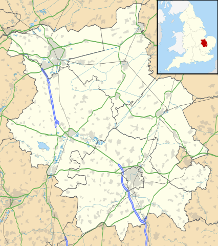
Map of Cambridgeshire, UK with the following information shown:
Equirectangular map projection on WGS 84 datum, with N/S stretched 160% Geographic limits:
|
| תאריך יצירה | |
| מקור |
|
| יוצר | Nilfanion, created using Ordnance Survey data |
| אישורים והיתרים (שימוש חוזר בקובץ זה) |
הקובץ הזה מתפרסם לפי תנאי רישיון קריאייטיב קומונז ייחוס-שיתוף זהה 3.0 לא מותאם. ייחוס: Contains Ordnance Survey data © Crown copyright and database right
|
| גרסאות אחרות | File:Cambridgeshire UK district map (blank).svg - Blank map |
.svg)
היסטוריית הקובץ
ניתן ללחוץ על תאריך/שעה כדי לראות את הקובץ כפי שנראה באותו זמן.
| תאריך/שעה | תמונה ממוזערת | ממדים | משתמש | הערה | |
|---|---|---|---|---|---|
| נוכחית | 21:41, 26 בספטמבר 2010 | | 1,266 × 1,125 (1.79 מ"ב) | Nilfanion | {{Information |Description=Map of Cambridgeshire, UK with the following information shown: *Administrative borders *Coastline, lakes and rivers *Roads and railways *Urban areas Equirectangular map projection on WGS 84 datum, with N/S |
שימוש בקובץ
הדפים הבאים משתמשים בקובץ הזה:
שימוש גלובלי בקובץ
אתרי הוויקי השונים הבאים משתמשים בקובץ זה:
- שימוש באתר ar.wikipedia.org
- שימוש באתר bg.wikipedia.org
- שימוש באתר ceb.wikipedia.org
- שימוש באתר en.wikipedia.org
- Kimbolton Castle
- St Ives, Cambridgeshire
- Littleport
- Ramsey Abbey
- St Neots
- Eye, Cambridgeshire
- Eye Green
- Werrington, Peterborough
- Grantchester
- Wisbech
- Coton, Cambridgeshire
- Flag Fen
- Burwell, Cambridgeshire
- Huntingdon
- Perry, Cambridgeshire
- Gamlingay
- Godmanchester
- Eynesbury, Cambridgeshire
- Eaton Ford
- Eaton Socon
- Kimbolton, Cambridgeshire
- Chesterton, Cambridge
- Cambourne
- Soham
- Duxford
- Ramsey, Cambridgeshire
- Orton, Peterborough
- Whittlesey
- March, Cambridgeshire
- Girton College, Cambridge
- Chatteris
- Caldecote, South Cambridgeshire
- Addenbrooke's Hospital
- The Abingtons, Cambridgeshire
- Meldreth
- Denny Abbey
- Wimpole Estate
- Anglesey Abbey
- Hampton, Peterborough
- Thorpe Hall (Peterborough)
- Isleham
- Witcham
- Fulbourn
- Great Wilbraham
- Little Wilbraham
- RAF Brampton